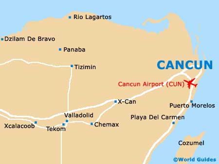
Cancun International Airport (CUN)
Orientation and Maps
(Cancun, Mexico)
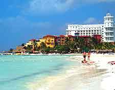
An important city in the Quintana Roo area of Mexico's Yucatán Peninsula, Cancun is located on the coastline. With a population of more than 450,000 inhabitants, the city of Cancun offers many Caribbean coastal attractions, including vast beach resorts with swimming pools and sandy stretches of white sand. The island of Cozumel is around 70 km / 43 miles south of Cancun and is famous for its exceptional scuba diving.
Located close to the city, Cancun International Airport (CUN) lies to the south-west. Also nearby are Puerto Juarez, Alfredo V Bonfil, Nizuc, Caracol and Puerto Morelos, all of which are located directly south and next to the sea.
Cancun International Airport (CUN) Maps: Important City Districts
The Cancun region consists of two main districts, the downtown neighbourhood, which is known as 'Ciudad Cancun', and the main hotel region, generally referred to as the Zona Hotelera. These areas are extremely different, with the main downtown area being rarely visited by tourists. The 'el centro' area of downtown Cancun is well developed and centered around the main artery of the Avenida Tulum, an attractive boulevard lined with shops and restaurants.
Nearby, the Zona Hotelera is often known as the 'Isle Cancun' and is connected to the rest of the region by the Boulevard Kukulcán, which heads in an easterly direction. Many enormous condominium developments can be found in this area, together with large shopping malls, convention centres, clubs and bars.
Mexico Map

Cancun Map